Sunday July 7 13:00 Forecast: Landfall of Hurricane Beryl around 100 miles north of Corpus. Latest Chart:
Hurricane Beryl. Elevated winds between Corpus and Galveston and still 7 hours for the path to change. Rotating clockwise, it should continue to bear NNE.
Sunday July 7 07:00 Forecast: Landfall of Hurricane Beryl around 75 miles north of Corpus. Latest Chart:
Heavy winds will hit Corpus, >39mph, with 3-5 ft tidal surge, but hopefully the eye of the hurricane will land 100 miles NW of Corpus, along the coast around 7pm Central. Anything can change in the next 12 hours.
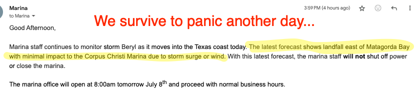
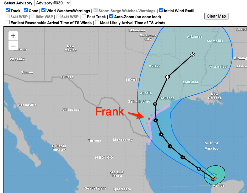
Saturday July 6 10pm Texas ChaCha and I spent a hot afternoon on Frank in Corpus replacing fenders and upgrading/changing/moving lines. We drove home through 4 hours of non-stop cloudbursts, thunder/lightning storms etc which came from Houston heading SW. Not the hurricane. Latest forecast (pic at bottom) says that Corpus may miss the worst of the hurricane, Corpus (and Frank) now being just outside the South-Western edge of the “cone”. Hopefully it keeps moving North East along the coast. I feel sorry for Rockport and Bay City if they take another direct hit as they did in 2017.
I dislike the June-November period – Hurricane Season.
Beryl, forecast to be a Hurricane by the time it lands on the Texas coast
The 16:00 CST forecast had it tracking straight at Corpus, so the tracking/forecast line has moved a few hundred miles up the coast in the last 24 hours, from Mexico to North East of Corpus. Due to the very warm, shallow coastal Gulf of Mexico waters the storm will pick up energy, but that also increases its clockwise rotation over the water, giving it impetus to move to the NEN (I hope).
Maybe Beryl will prefer Houston…
July 6th, 07:00 CDT – No change in track.
July 6th 22:00 CDT – Forecast track has moved North along the coast a tad and the cone (“spread”) has narrowed slightly as Beryl moves closer
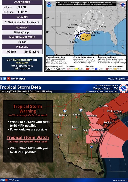
UPDATE Below @ 10:00 hrs Sept 20 from US Weather Service
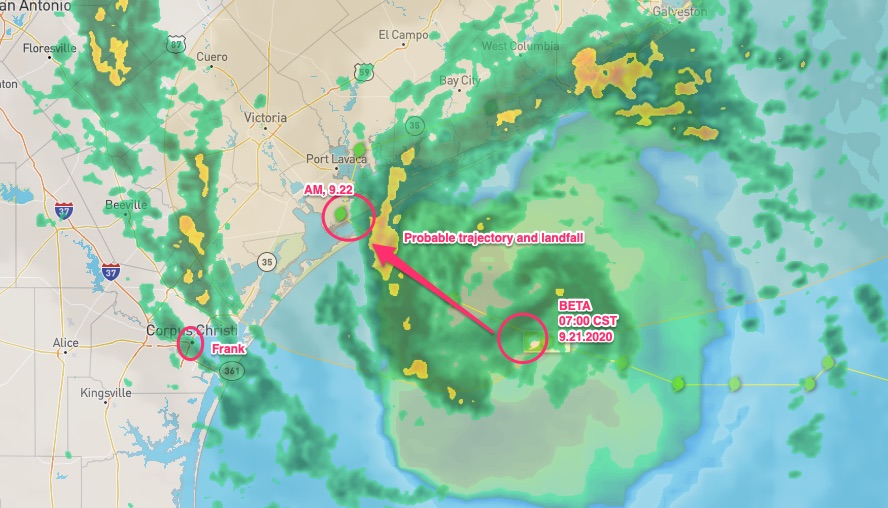
Upperdate Below @ 07:00 hrs Sept 21.
It is still September – 20th today, and already the publicists at the weather forecasters have run out of letters of the alphabet. For some reason, the meteorological alphabet runs from A to T. So rather than use the Japanese model and number storms, they went Greek for “the second time since the ’50s” That’s so we blame it on #climatechange. Right. Storm Beta is this week’s concern.
So here we are again, checking on Frank. Last night was quite cool, so I slept well. The Marina had emailed that they were going to close off the cap park and vehicle access to the piers at 9am. So I moved the truck last night.
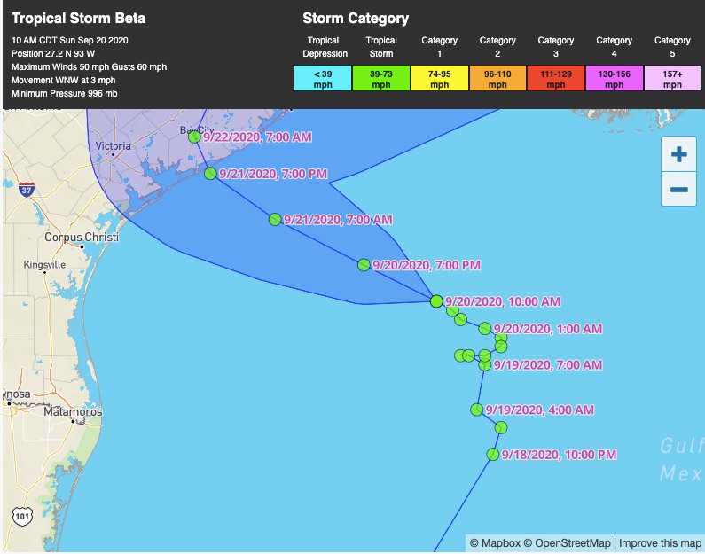
Woke to a beautiful morning with a cooling breeze and some haze. And an email saying that pier access is now open until Midday. Here’s why:
Hopefully, Beta will keep nudging North West.
If a picture is worth a thousand words, here’s 2,000.
TS Beta, 07:00 CST, September 21 2020. Should be ok.