Beryl is a no-show…
Sunday July 7 13:00 Forecast: Landfall of Hurricane Beryl around 100 miles north of Corpus.
Latest Chart:

Sunday July 7 07:00 Forecast: Landfall of Hurricane Beryl around 75 miles north of Corpus.
Latest Chart:

Saturday July 6 10pm Texas ChaCha and I spent a hot afternoon on Frank in Corpus replacing fenders and upgrading/changing/moving lines.
We drove home through 4 hours of non-stop cloudbursts, thunder/lightning storms etc which came from Houston heading SW. Not the hurricane.
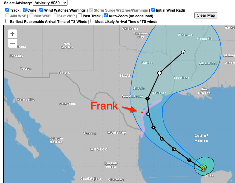
Latest forecast (pic at bottom) says that Corpus may miss the worst of the hurricane, Corpus (and Frank) now being just outside the South-Western edge of the “cone”. Hopefully it keeps moving North East along the coast. I feel sorry for Rockport and Bay City if they take another direct hit as they did in 2017.
I dislike the June-November period – Hurricane Season.
Hoping that Beryl keeps moving right as it rotates through the Gulf of Mexico.
The 16:00 CST forecast had it tracking straight at Corpus, so the tracking/forecast line has moved a few hundred miles up the coast in the last 24 hours, from Mexico to North East of Corpus. Due to the very warm, shallow coastal Gulf of Mexico waters the storm will pick up energy, but that also increases its clockwise rotation over the water, giving it impetus to move to the NEN (I hope).


July 6th 22:00 CDT – Forecast track has moved North along the coast a tad and the cone (“spread”) has narrowed slightly as Beryl moves closer